ECOZONE
PRAIRIE
ECOREGION
Mixed Grassland

Hectares: 8,671,000 ha (13%)
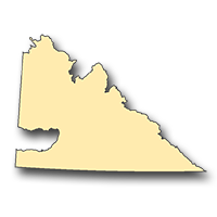
This ecoregion represents the driest area of the province as evidenced by the absence of native trees and scarcity of wetlands and permanent water bodies. Its diverse landscapes include level, glacial lake plains; dune-covered, sandhill areas; the hilly, pothole country along the Missouri Coteau; and the rolling expanses of native grassland and intermittent "badlands" near the United States border. The native grasslands are characterized mainly by wheatgrasses and speargrasses and, to a lesser extent, by blue grama grass which gains prominence on extremely droughty soils or under high grazing pressure. Shrub communities composed of snowberry and wolf willow are found in areas of favourable soil moisture.
Aspen, which is characteristic in and around moist depressions in the Moist Mixed Grassland ecoregion, is generally absent here except in valley bottoms and sandhill areas. Pronghorn antelope, white-tailed and mule deer, coyote, jack rabbit, Richardson's ground squirrel, horned lizard, prairie rattlesnake and western painted turtle are typical of the region. The only Canadian population of black-tailed prairie dog is found here.
Characteristic birds include ferruginous hawk, long-billed curlew, yellow-breasted chat, chestnut-collared longspur, burrowing owl and sage grouse. About half of the area is cultivated, with the remainder used for extensive grazing of livestock on native or introduced grasses. Cereals are the main crop on cultivated land, although feed grains, forages and oilseeds are also grown.
LANDSCAPE AREA
- M1 Kerrobert Plain
- M2 Sibbald Plain
- M3 Oyen Upland
- M4 Eston Plain
- M5 Bad Hills
- M6 Acadia Valley Plain
- M7 Bindloss Plain
- M8 Hazlet Plain
- M9 Schuler Plain
- M10 Maple Creek Plain
- M11 Great Sand Hills
- M12 Antelope Creek Plain
- M13 Gull Lake Plain
- M14 Beechy Hills
- M15 Coteau Hills
- M16 Chaplin Plain
- M17 Swift Current Plateau
- M18 Wood River Plain
- M19 Dirt Hills
- M20 Coteau Lakes Upland
- M21 Lake Alma Upland
- M22 Wood Mountain Plateau
- M23 Climax Plain
- M24 Old Man on his Back Plateau
- M25 Wild Horse Plain