ECOZONE
BOREAL PLAIN
ECOREGION
Mid-Boreal Upland

Hectares: 10,150,000 ha (16%)
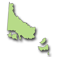
This ecoregion includes the area in central and western Saskatchewan immediately south of the Shield, as well as several prominent upland areas known locally as the Thickwood, Pasquia and Porcupine Hills. Typically, the upland areas are characterized by an ascending sequence of steeply sloping, eroded escarpments, hilly glacial till plains and level plateau-like tops. The intervening areas are comparatively level, with large, sparsely treed peatlands being common.
Most of the ecoregion is characterized by loamy, gray soils, although near the Shield the soils are sandy and often poorly drained. The forests grow taller here than on the Shield and account for the bulk of the province's merchantable timber. Aspen occurs throughout the ecoregion and is dominant on the south-facing slopes of the major uplands. Where moisture conditions are favourable, white spruce is often mixed with aspen. Jack pine, in addition to its usual dominance in sandy areas, is found mixed with black spruce on the plateau-like tops of the uplands. Black spruce and tamarack dominate the low-lying peatland areas.
Wildlife populations are high and diverse with moose, woodland caribou, mule deer, white-tailed deer, elk, black bear, timber wolf and beaver being the most prominent. White-throated sparrow, American redstart, ovenbird, hermit thrush and bufflehead are typical birds. Fish populations include northern pike, walleye, whitefish, some perch and scattered populations of lake trout.
LANDSCAPE AREA
- E1 Firebag Hills
- E2 Garson Lake Plain
- E3 Palmbere Plain
- E4 Christina Plain
- E5 Dillon Plain
- E6 Ile-a-la-Crosse Plain
- E7 Canoe Lake Lowland
- E8 Mostoos Upland
- E9 Primrose Plain
- E10 Mostoos Escarpment
- E11 Waterhen Plain
- E12 La Plonge Plain
- E13 Mahigan lake Plain
- E14 Dore Lake Lowland
- E15 Smoothstone Plain
- E16 Clarke Lake Plain
- E17 Leoville Hills
- E18 Waskesiu Upland
- E19 La Ronge Lowland
- E20 Wapawekka Upland
- E21 Montreal Lake Plain
- E22 Emma Lake Upland
- E23 Whiteswan Upland
- E24 White Gull Plain
- E25 Bronson Upland
- E26 Thickwood Upland
- E27 Pasquia Escarpment
- E28 Pasquia Plateau
- E29 Porcupine Hills
- E30 Duck Mountain