ECOZONE
BOREAL PLAIN
ECOREGION
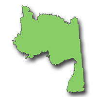
Mid-Boreal Lowland

Hectares: 2,154,000 ha (3%)
At an elevation of less than 400 metres, this relatively flat, low-lying ecoregion is dominated by wetlands. Peatlands supporting open stands of tamarack and black spruce are prevalent in the northern part, although sandy glacial deposits and limestone outcrops also occur there. To the south lies the flood plain of the Saskatchewan River featuring both active and abandoned river channels and their associated levees.
The levees, which are built up by the periodic deposition of river sediments, rise abruptly from the river channel and then slope gently back from the river into an area of marshes, fens and poorly drained meadows. Most of the levees are well drained and represent the most productive forest lands in the province. Large white spruce, balsam poplar and aspen are found there along with an assortment of less common hardwoods such as American elm, green ash and Manitoba maple. The levees are also a productive habitat for wildlife, although wildlife populations in general are lower here than in the Mid-Boreal Upland.
The most conspicuous species include moose and woodland caribou. The floodplain and associated marshes form a unique waterfowl and muskrat habitat. Typical birds include common loon, Canada warbler, ruby-crowned kinglet and white-breasted nuthatch.
LANDSCAPE AREA
- F1 Mossy river Plain
- F2 Namew Lake Upland
- F3 Saskatchewan Delta
- F4 Overflowing River Lowland