ECOZONE
BOREAL SHIELD
ECOREGION
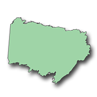
Athabasca Plain

Hectares: 7,398,000 ha (11%)
Landscapes in this ecoregion appear less rugged than elsewhere on the Shield due largely to the flat-lying sandstone bedrock and the almost continuous cover of sandy glacial deposits. Lakes and wetlands are also less numerous. The spectacular sand dune area along the south shore of Lake Athabasca is the area's most outstanding feature.
Other prominent features include eskers, flutings and drumlins, which mark the northeast-southwest direction of ice movement during the last glaciation. Young, open stands of jack pine are common due to the sandy, droughty soils and the high frequency of fire. Pine-spruce forests are found in the drumlin area, while stands of black spruce and white birch occur on the lower slopes of the dunes. The dune area harbours several species of plants, such as Turnor's willow, sand chickweed and Mackenzie hairgrass, which are not found anywhere else in the world.
Both the populations and the diversity of wildlife are low compared to elsewhere on the Shield. Local populations of moose along with black bear and timber wolf are the most prominent. The migratory barren-ground caribou and associated arctic fox are sometimes found in the region during winter. The white-winged crossbill, Cape May warbler, blackpoll warbler and Bohemian waxwing are typical birds.
LANDSCAPE AREA
- C1 Athabasca Dunes
- C2 Carswell Plain
- C3 McTaggart Plain
- C4 Mcfarlane Upland
- C5 Livingstone Plain
- C6 Squirrel Lake Plain
- C7 Fond du Lac Lowland
- C8 Lower Cree River Plain
- C9 Pasfield Lake Plain
- C10 Pine River Plain
- C11 Cree Lake Upland
- C12 Wheeler Upland